

Lead Soil Sampling in the Philadelphia Region
Calling all Citizen Scientists!
About | Map | Interpreting Results | Get Involved
The Centers for Disease Control and Prevention (CDC) categorizes lead poisoning as elevated blood lead levels (EBLLs) meeting or exceeding 5 micrograms per deciliter (µg/dL). In 2018, 3.2% of the 37,584 children screened by the Philadelphia Public Health Department had EBLLs between 5-9 ug/dL. The highest percentage of children with EBLLs continues to be found in zip codes of high poverty and housing stock built before 1950. Data from the Philadelphia Department of Health revealed that 36 Philadelphia census tracts reported that 10% of tested children had EBLLs.
Main Sources of Lead Exposure:
– Deteriorating lead paint,
– Pre-1950 private water service lines
– Dust from demolition
– Soil contaminated by legacy pollutants from lead-based gasoline emissions, paint, and industry
Lead exposure from soil in post-industrial, older cities is expected to be higher due to the multiple lead sources that have contributed to soil. However, there has not been a systematic assessment of soil lead in Philadelphia. Over the last decade, Richard Pepino and his undergraduate students have been collecting and testing soil for lead through his Academically Based Community Service Course through the Netter Center. Once mapped, the data helped to visualize soil lead at the neighborhood level.
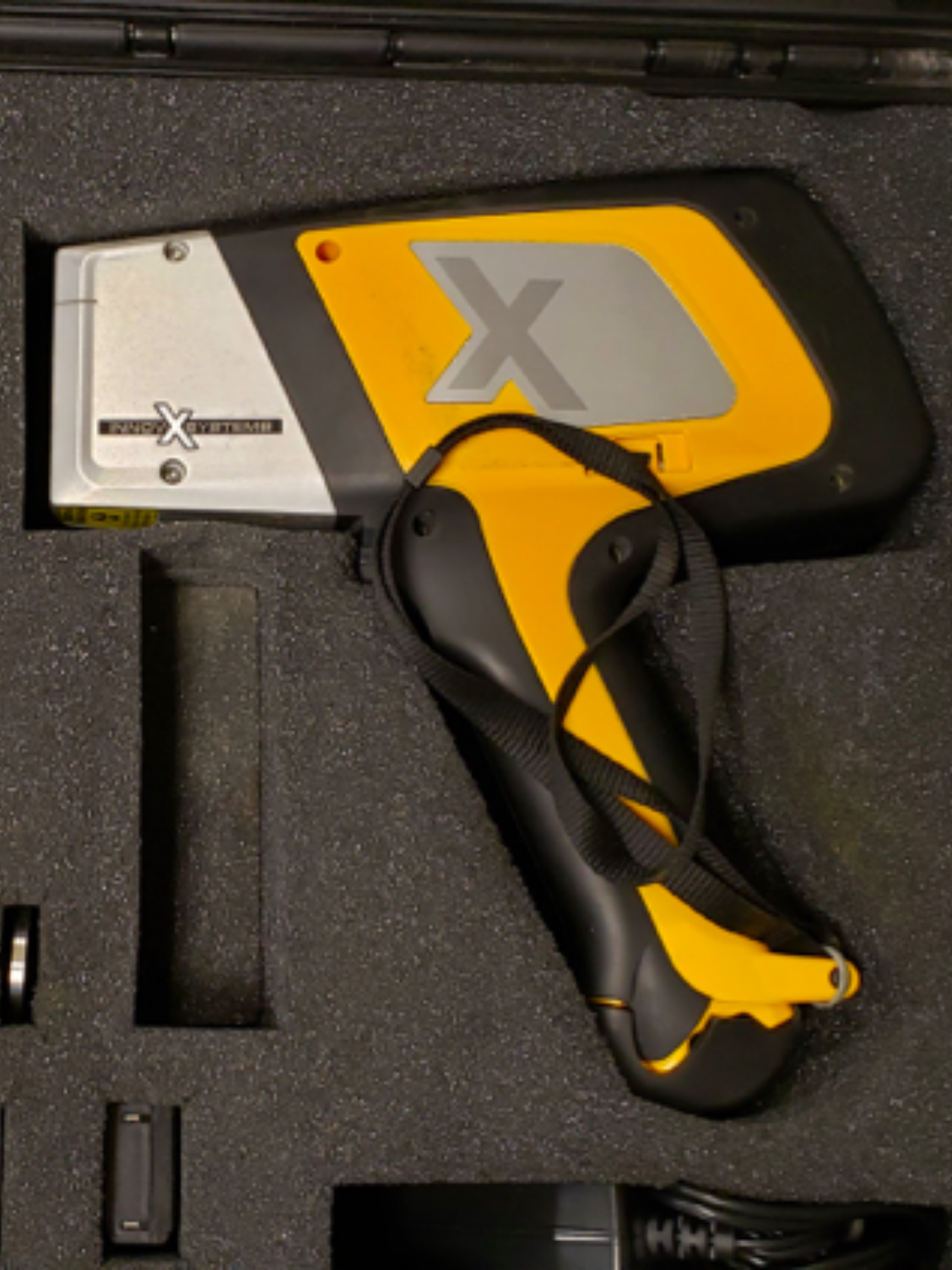
CEC has worked with healthcare professionals, governmental entities, students, and communities to consolidate historic lead soil data and collect samples of soil to test for lead contamination using a Delta X-Ray Fluorescence (XRF) portable analyzer.
Our aims in this endeavor are to:
– Learn the scope of lead soil elevations at the neighborhood level in Philadelphia
– Identify areas with levels in need of EPA remediation
– Create an on-line resource for community use
– Design engagement opportunities around the mapped data for health education and exposure reduction

Mr. Richard Pepino is the Deputy Director of the Community Engagement Core of CEET and the Coordinator of the University of Pennsylvania’s Netter Center’s Academically Based Community Service (ABCS) courses in the Department of Earth and Environmental Sciences.
In 1995, the University of Pennsylvania first offered Environmental Studies 404, The Urban Environment. Led by Dr. Robert Giegengack, this course was designed to introduce students to the urban environmental and engage in service-learning programs around lead with local schoolchildren. In the early 2000s, Mr. Pepino took over this course, now part of the ABCS curriculum entitled Urban Environments: Speaking about Lead in West Philadelphia. In this course Penn undergraduates collaborate with middle school and high school teachers in West Philadelphia to engage students in exercises that apply environmental research relating to lead poisoning to their homes and neighborhoods, including the collection and testing of soil samples in Philadelphia. We currently have over 3,000 samples collected, tested, and mapped due to the collaborative effort of Mr. Pepino, the University of Pennsylvania’s Netter Center for Community Partnerships, University of Pennsylvania’s Department of Earth and Environmental Science, and the Philadelphia Public School District.
![]()


![]()
Map
Each colored point on the map represents one soil sample. Use the double arrow symbol in the top left corner to show the map legend. Larger, darker points represent higher lead concentrations. Use the plus and minus in the top left corner to zoom in and out of the map. Click on a point to view the lead concentration and coordinates for that sample.
See below for interpretation of lead soil concentrations. 200 ppm is the new EPA current regulation for safe bare soil in children’s play areas. At residential properties with multiple sources of lead exposure (like those in Philadelphia), the EPA will use 100 ppm as the screening level.
Disclaimer: These points are may not be exact. GPS data are sometimes estimates based on near addresses or cross streets. Also, lead soil levels vary greatly even within inches. Any high or low lead level in soil may not represent the lead risk of the entire property.
This map contains a combination of soil data from the Center of Excellence in Environmental Toxicology, the Environmental Protection Agency, and La Salle University.
![]()
![]()
…
…
Interpreting Lead Soil Concentrations
Lead is naturally occurring in soil at very low amounts, commonly below 40 parts per million (ppm). High soil lead levels pose a risk of human lead exposure. Lead is especially a hazard to children and pregnant women because of lead’s toxic effects on the developing brain. Soil near homes and structures painted with lead- based paint are at risk of contamination due to flaking and weathering. Soil near busy roads may have been exposed to lead-gasoline vehicles in the past.
Reminder of current EPA regulations:
– 200 ppm for bare soil in children’s play areas
– 1,200 ppm for non-play areas
Understanding Lead Soil Concentrations [download PDF]
| Soil Lead Level (ppm) | Level of Lead Contamination | What this means to you |
| Less than 150 | None to very low | Little to no health risk. However, remain aware that other possible sources of lead may exist. |
| From 150 to 400 | Low | Reduce children’s exposure and play Wash hands after playing outside Maintain grass, or mulch, over bare soil Discourage children’s play. Gardens: wash all vegetables with 1% vinegar solution; peel root crops; do not compost peelings/leaves |
| From 400 to 1,000 | Medium | Restrict children’s access to soil. Cover soil with dense grass, or mulch. Gardens: grow vegetables in raised beds filled with non-contaminated soil |
| From 1,000 to 2,000 | High | Do not allow children to access soil. Do not grow vegetables. |
| Greater than 2,000 | Very High | Contact your local health department |
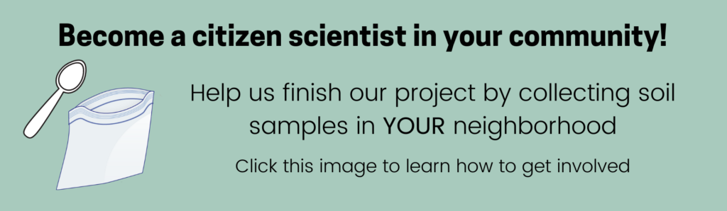
Get Involved
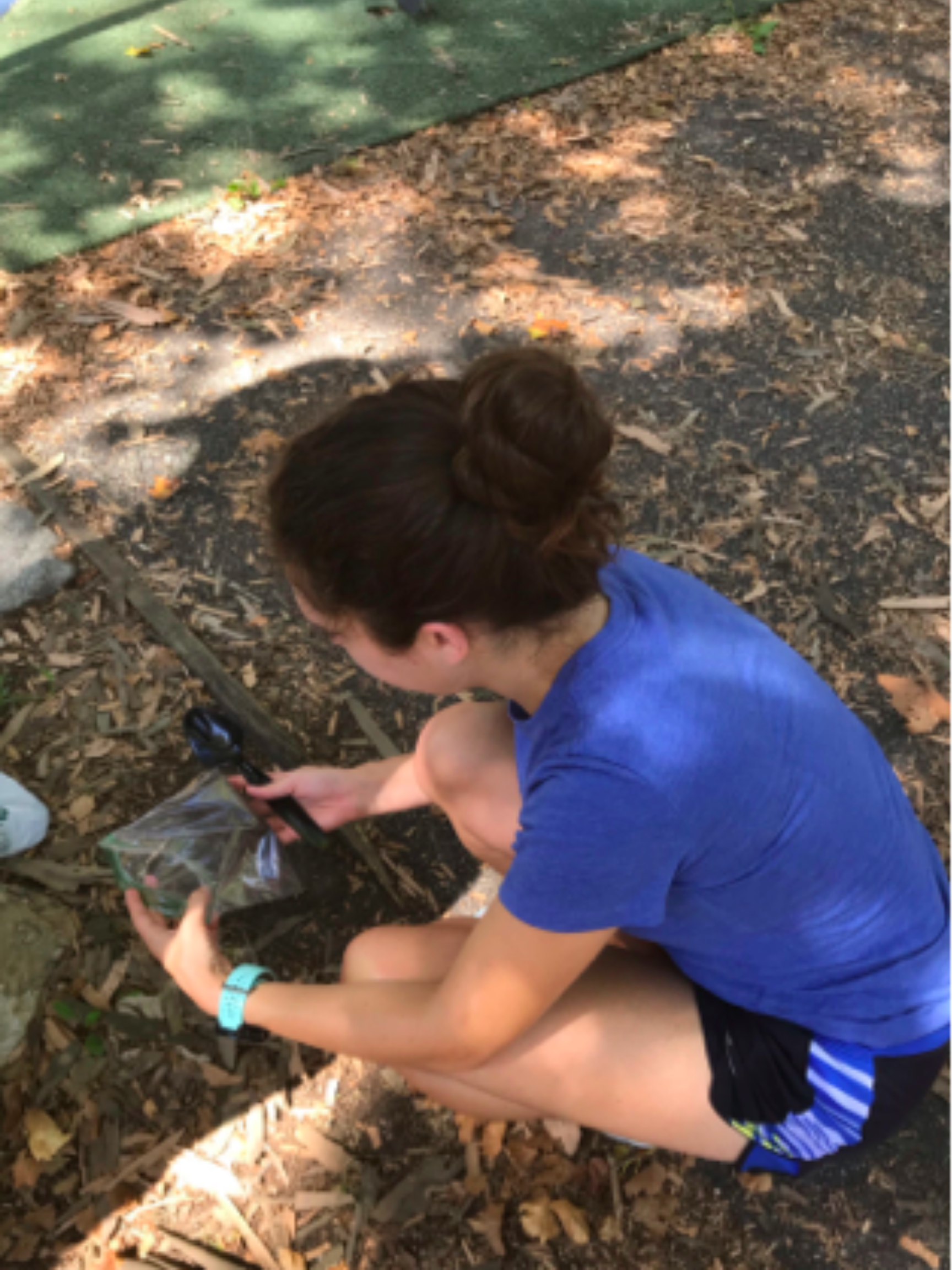
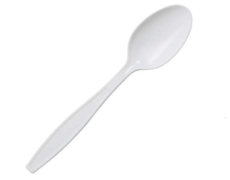
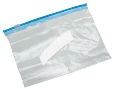
Our goal is to have samples in every census tract in Philadelphia. We currently have soil samples in 329 out of the 384 census tracts in Philadelphia. We would love your help to get soil samples in every neighborhood in Philadelphia! In the map below, the red shaded areas are census tracts in Philadelphia where soil samples still need to be collected. We would also be happy to test soil samples from other areas. If you would like to help, all you need is a plastic spoon, a permanent marker, and a clean plastic bag. See below for details on how to collect soil samples.
How to Collect Soil Samples [download pdf]
What you will need:
- A clean plastic spoon
- A permanent marker
- A clean plastic bag with Ziploc closure
What you will need to do:
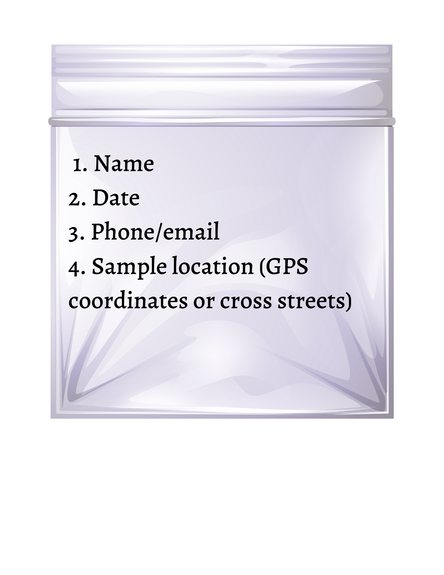
- Choose a sampling location. With the permanent marker, write your name, the date, and location on each plastic bag. For the location, GPS coordinates are preferred, nearest street address second option. See instructions below on how to take coordinates on your phone.
- Choose a sampling location and imagine there is a large “X” on the bare ground, with each line of the X about 2 feet long. (If you prefer, you can lay down an X with two pieces of string.)
- Using the plastic spoon, scoop up a small sample from the top half-inch of soil at the center of the X and put it in the plastic bag.
- In the same way, collect a soil sample at each corner of the X. When finished you will have 5 samples in the bag.
- Repeat this procedure at every location you have chosen.
How to collect GPS coordinates on your smartphone:
Android:
- On your Android phone or tablet, open the Google Maps app.
- Touch and hold the area of the map that corresponds to your sample location. You’ll see a red pin appear.
- You’ll see the coordinates in the search box at the top.
- Write the entire number on the sample bag.
iPhone:
- On your iPhone, open the Maps app.
- Touch and hold the area of the map that corresponds to your sample location. You’ll see a red pin appear.
- An information window will pop up at the bottom of your screen. Scroll down to view coordinates.
- Write the entire number on the sample bag.
When you are finished, contact Adrian Wood, who work with you to coordinate receiving the samples.
[e-mail: adrian.wood@pennmedicine.upenn.edu]